

Bạn đang theo dõi
Lỗi khi theo dõi người dùng.
Người dùng này không cho phép người dùng khác theo dõi họ.
Bạn đã theo dõi người dùng này rồi.
Gói thành viên của bạn chị cho phép 0 lượt theo dõi. Hãy nâng cấp lên ở đây.
Bỏ theo dõi thành công
Lỗi khi bỏ theo dõi người dùng.
Bạn đã đề xuất thành công
Lỗi khi đề xuất người dùng.
Đã xảy ra lỗi. Hãy làm mới trang và thử lại.
Đã xác thực email thành công.

lahore,
pakistan
Hiện ở đây đang là 8:38 CH
Đã tham gia vào tháng 7 13, 2017
0 Khuyến nghị
Muneeb A.
@MUNEEBAAMIR
0,0
0,0
0%
0%
lahore,
pakistan
Không áp dụng
Công Việc Hoàn Thành
Không áp dụng
Đúng Ngân Sách
Không áp dụng
Đúng Thời Hạn
Không áp dụng
Tỉ Lệ Thuê Lại
Geospatial Expert
Liên hệ Muneeb A. về công việc của bạn
Đăng nhập để thảo luận thông tin thông qua chat.
Portfolio
Portfolio


Preparation of Digital Elevation Model

Drone Mapping

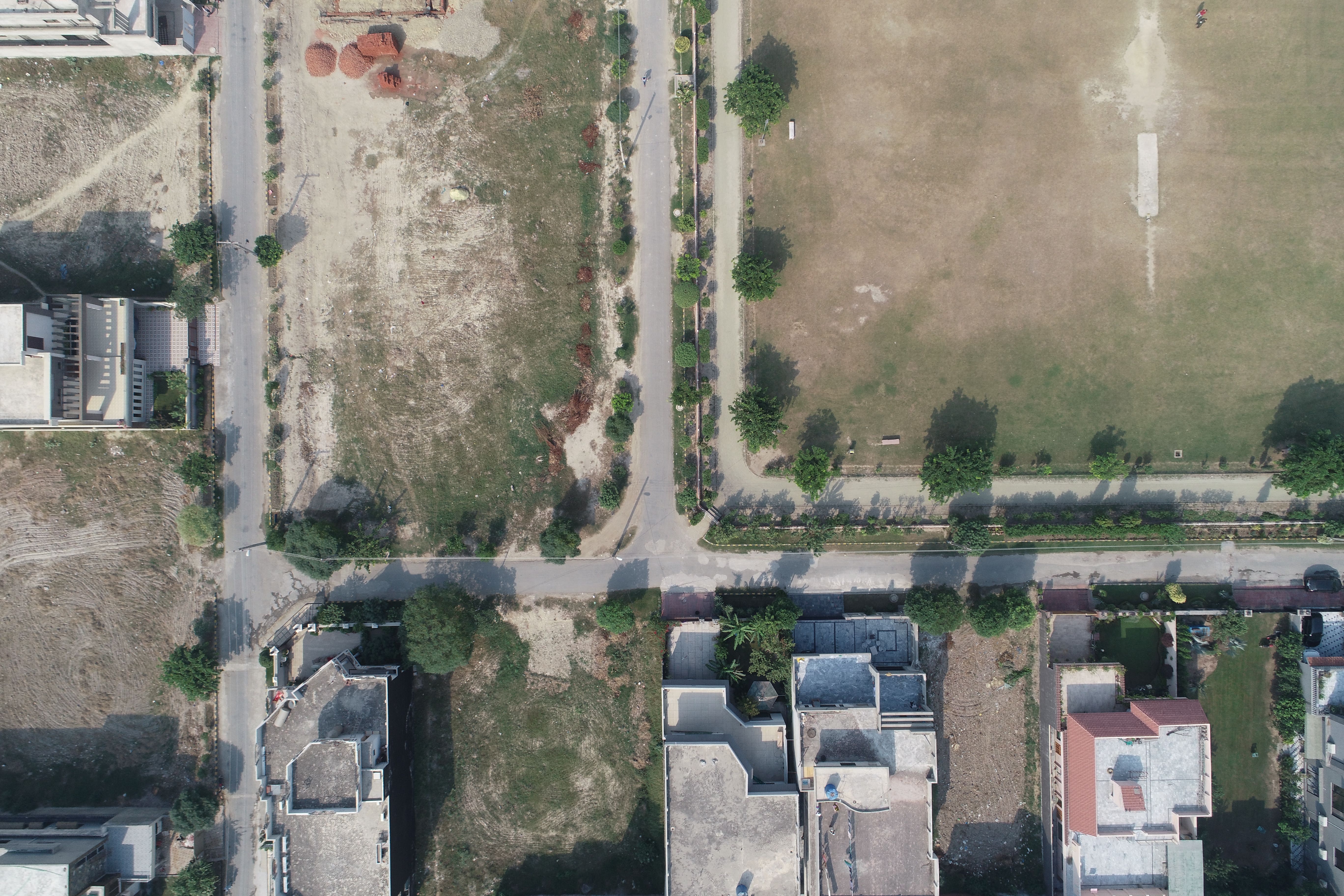
Drone Mapping

Drone Mapping
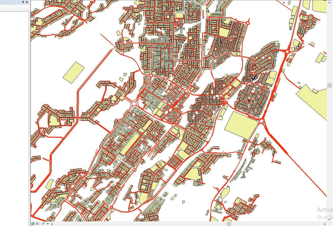

CAD to SHP Files

CAD to SHP Files
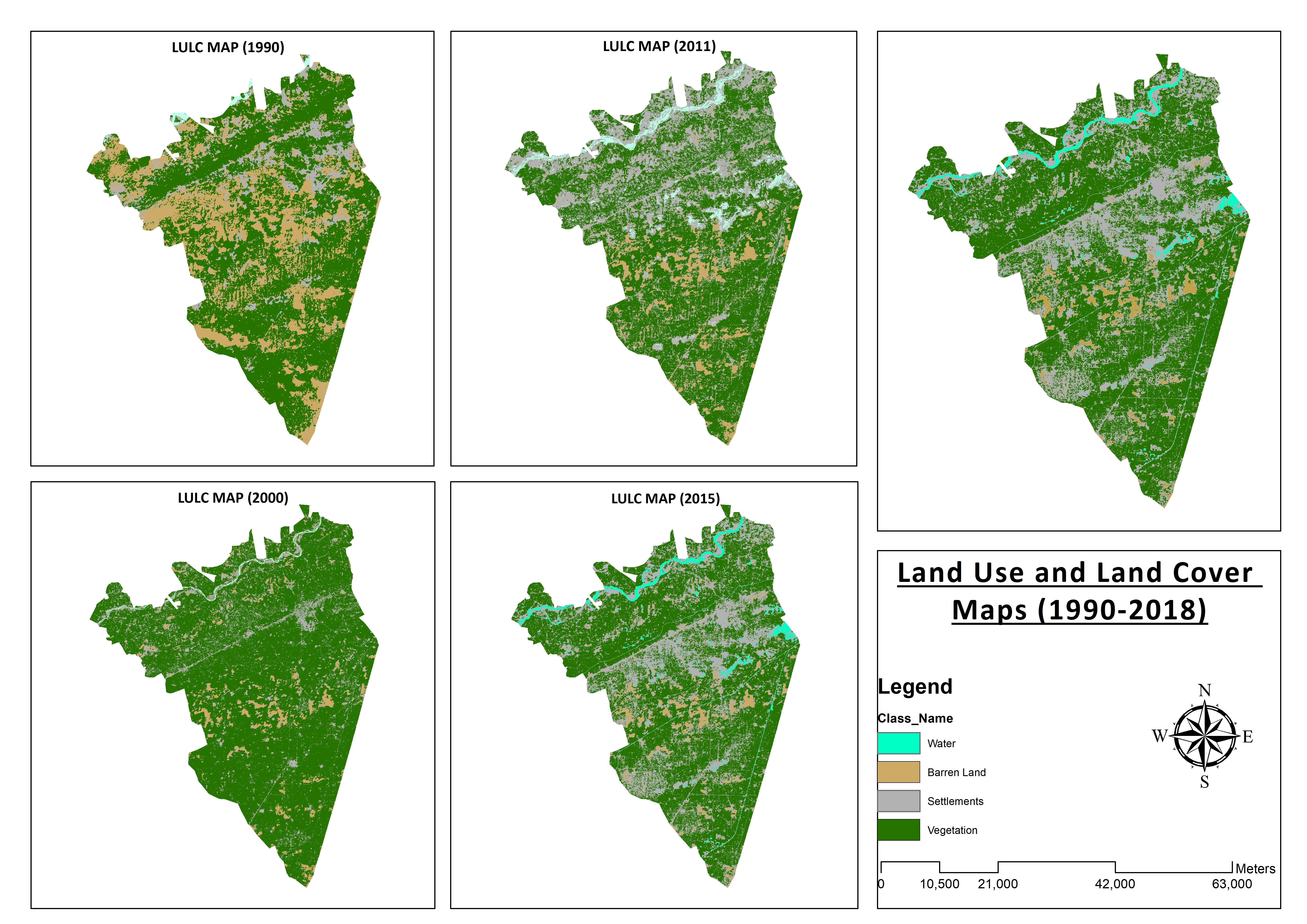

Land Use and Land Cover Maps
Preparation of Digital Elevation Model
Drone Mapping
Drone Mapping
Drone Mapping
CAD to SHP Files
CAD to SHP Files
Land Use and Land Cover Maps
Nhận xét
Đã lưu thay đổi
Chưa có nhận xét nào để xem ở đây!
Kinh nghiệm
Remote Sensing and GIS Analyst
thg 9 2018 - thg 10 2019 (1 năm, 1 tháng)
Developed, integrated and Implemented GIS and Geodesy based Topographic Survey Plans under different Hydro-Power Projects in Northern Pakistan, Extension of Canal Projects to increase its capacity in Sindh-Balochistan, Analysis of Suitable Site Selection for different development sites by using Drone for Aerial Mapping and their detailed pre-feasibility studies with different softwares, to analyse and interpret spatial data to produce interacting Maps and Reports while ensuring quality control.
Research Associate GIS
thg 10 2015 - thg 10 2018 (3 năm)
Deployed GIS-based system under Urban Immovable Property Tax (UIPT) for Punjab Excise & Taxation Department. Provided comprehensive support in creating the system while take advantage of software suites like ArcGIS Suite and ERDAS Imagine. Prepared communicating maps to help surveyors in Analyzing geo-spatial data to verify it during ground truthing. Created shapefiles to merge topographical data with external data through layering process.
Học vấn
Master of Philosophy in Geographic Information System
(2 năm)
Bachelors in Geographic Information System
(4 năm)
Bằng cấp
MS-Office
TEVTA
2017
MS-Office Certification in MS-Word, Excel and Power Point.
Nội dung đã đăng
Analysis of Flood Damage Assessment through Different Satellite Datasets in Southern Punjab,Pakistan
International Journal of Innovations in Science & Technology
RS and GIS techniques can achieve the objectives and significant analyses through visual interpretations. These techniques are also used to identify the flood affected regions. The study site was examined by applying supervised classification determining that 16900.96 Hectors of agriculture land was damaged while Sparse Riverine Forest had the area 44.52 hectors. The damaged built-up area was 1805.78 Hectors.
Estimation of Net Rice Production by Remote Sensing and Multi Source Datasets
Sarhad Journal Of Agriculture
Estimation of net crop production before harvest enables agronomists and decision makers to determine the volume of grain precisely. Yield estimation is one of the challenging tasks which is significant to evaluate accurately for farmers. This research was conducted in eastern Punjab Pakistan by incorporating yield/area as reported by Crop Reporting Service Department along with open source satellite datasets.
Liên hệ Muneeb A. về công việc của bạn
Đăng nhập để thảo luận thông tin thông qua chat.
Xác thực
Các kỹ năng hàng đầu
Xem Các Freelancer Tương Tự
Xem Các Trường Hợp Tương Tự
Đã gửi lời mời thành công!
Cảm ơn bạn! Chúng tôi đã gửi email chứa đường link để bạn lấy tín dụng miễn phí.
Đã xảy ra lỗi trong khi gửi email của bạn. Hãy thử lại.
Sao chép vào clipboard thất bại, hãy thử lại sau khi điều chỉnh quyền của bạn.
Đã sao chép vào clipboard.
Đang tải xem trước
Đã cấp quyền truy cập vị trí.
Phiên đăng nhập của bạn đã hết hạn và bạn đã bị đăng xuất. Hãy đăng nhập lại.